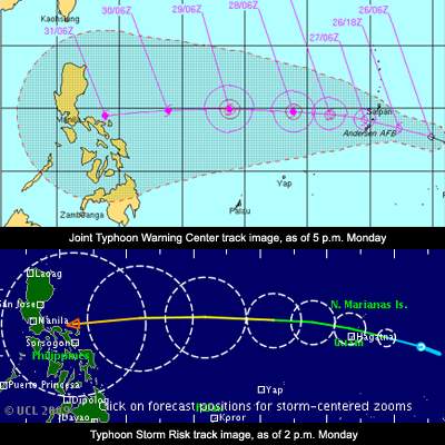
Brewing storm likely to hit RP in 3 days – Pagasa
After Typhoon Ramil spared the Philippines over the weekend, another weather disturbance is threatening to hit the country within the next three days, the state weather bureau said Monday afternoon. Prisco Nilo, head of the Philippine Atmospheric, Geophysical and Astronomical Services Administration (Pagasa) said the cyclone (named Tropical Depression 23) could enter Philippine territory on Thursday or Friday. It would be named Santi once it enters the Philippine area of responsibility. Next to Pepeng, Quedan, and Ramil, the new weather disturbance is the fourth cyclone to visit the Philippines for the month of October. "Papasok sa Philippine area of responsibility mga bandang October 29 or 30. Ito ay di pa makaka-apekto sa alinmang bahagi ng bansa sa susunod na tatlong araw," Nilo said in an interview on dzBB radio. He added that the following areas should brace for the weather disturbance’s effects: Visayas, southern Luzon, Bicol Region, Central Luzon, and Metro Manila.