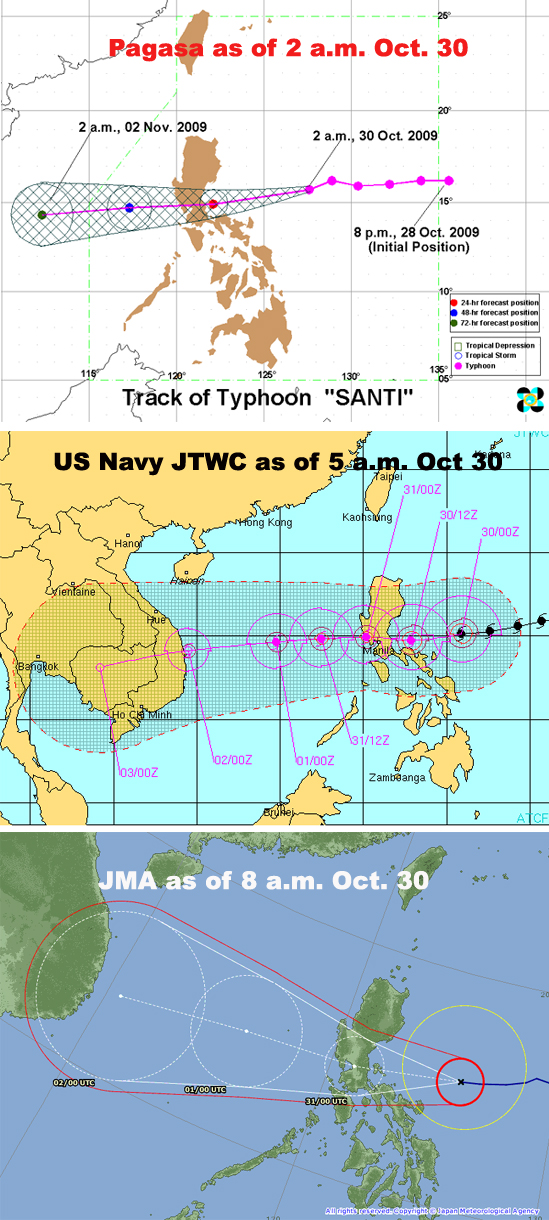
'Santi' on straight path to CLuzon for Saturday landfall
Unlike its zigzagging and pussyfooting predecessor "Ramil", Typhoon Santi is following nearly a straight path towards Central Luzon and is expected to make landfall Saturday morning. But as early as Friday, the Philippine Coast Guard has canceled boat trips from Aurora to Camarines Sur, including ships leaving from Manila's North Harbor, and the Department of Education has suspended classes at the elementary and high school levels. Storm signal number two has been hoisted from Bicol to Central Luzon, suspending commercial boat travel and stranding scores of passengers hoping to be in their hometowns for Undas, or All Souls' Day. But bus travel should still be safe until Friday afternoon, according to Pagasa spokesman Nathaniel Cruz. The fourth cyclone to enter the Philippine area of responsibility since the last week of September, Santi is packing maximum winds of 150kph but is also expected to bring rains to Metro Manila and surrounding provinces, the state weather bureau said Friday morning. Its predecessor Ramil shifted directions several times and kept much of Luzon on edge for over a week before veering away towards Taiwan and eventually Japan. On weather maps, Santi's eye is charging like a bowling ball towards a sure strike on Aurora province. Then it is expected to barrel across Nueva Ecija and Pampanga, provinces hard hit by flooding caused by Ondoy's epic rainfall a month ago. Still reeling but also perhaps learning from the impact of Ondoy, local governments have set up alarm systems, packed relief goods, and started preparing for mass evacuations in case of another disastrous storm.